


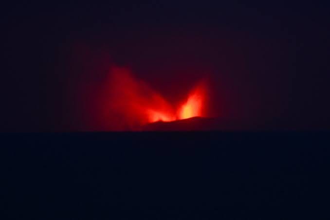
Mount Anak Krakatau erupting at night. Source: The Jakarta Post
Indonesia is a nation that lies across the equator, spread across a vast archipelago of over 17,000 islands. It lies along the Pacific “Ring of Fire”, which marks the active collision zone of multiple major tectonic plates, specifically the Indo-Australian, Eurasian, and Pacific plates, increasing the chances of natural disasters. With over 120 active volcanoes, Indonesia holds the record for the highest number of active volcanoes in the world. The country’s landscape is a continuous variation between the constructive forces of magma that create fertile soils and the destructive forces of eruptions that displace thousands. Between 2024 and 2026, Indonesia has grabbed the world’s attention as an active volcanic hotspot emerging from the earth’s crust.
The period between 2024 and 2026 has been marked by a significant upsurge in volcanic activity across different islands in the Indonesian archipelago. These eruptions have not only impacted local communities but have also caused severe international disruptions, particularly in aviation and global travel.
The Awakening of Anak Krakatau (September 2026)
In September 2026, Mount Anak Krakatau, located in Indonesia's Sunda Strait between the main Java and Sumatra islands erupted and caused major problems worldwide. Its name means "Child of Krakatoa," named after the famous volcano Krakatoa that violently blew up in 1883. When the older Krakatoa erupted, it pushed out so much lava that its underground chamber emptied, causing the mountain to collapse in on itself and form a massive, bowl-shaped crater called a caldera. In 1927, the new volcano began growing straight out of the ocean from inside that underwater crater. During this recent September eruption, the young volcano shot a giant cloud of ash 50,000 feet high into the sky.
Volcanic ash spread across parts of Jakarta and Lampung province on Sumatra's southern tip, Indonesia's Center for Volcanology and Geological Hazard Mitigation said. AirNav Indonesia closed airspace around Soekarno-Hatta and Halim Perdanakusuma airports in Jakarta, as well as six other airports, including Radin Inten II Airport in Lampung, because of volcanic ash. Over 1,500 flights were cancelled, stranding roughly 170,000 passengers and disrupting international trade routes. The eruption served as a stark reminder of how a localised geological event can instantaneously paralyse modern global infrastructure.
The Ash of Mount Lewotobi Laki-Laki (2024–2025)
Mount Lewotobi Laki-Laki and its twin, Lewotobi Perempuan, located in eastern Indonesia on the island of Flores, form a volatile volcanic eruption site. Between November 2024 and April 2025, Lewotobi Laki-laki Volcano (1,584 m a.s.l.), situated in Flores Regency, East Nusa Tenggara, Indonesia, exhibited eruptive activity that significantly impacted the surrounding environment. In 1861, the first formally recorded historical eruption of Mount Lewotobi Laki-Laki occurred typically characterised by mild eruptions involving ash emission, lava flows, and dome formation. Eruptions were driven by the subduction of the Indo-Australian plate beneath the Eurasian plate along the Sunda Arc. As trapped water melted mantle rock, silica-rich andesitic magma rose. This thick magma trapped volcanic gases, building intense pressure until explosive blasts launched ash columns, lava flows, and pyroclastic surges across the island.
The July 2025 event was particularly fierce, ejecting an ash cloud 18 kilometres into the sky. Unlike short-lived explosive events, Lewotobi’s prolonged activity has severely impacted the local climate and agriculture. Ashfall blanketed surrounding villages, destroying crops and poisoning water supplies. The Indonesian Centre for Volcanology and Geological Hazard Mitigation (PVMBG) kept the region on high alert well into 2026, forcing long-term evacuations and disrupting the livelihoods of thousands of farmers who rely on the slopes for agriculture.
The Tsunami Threat of Mount Ruang (April 2024)
In April 2024, the stratovolcano Mount Ruang in North Sulawesi erupted violently at least five times within a matter of days. The eruptions were accompanied by displays of volcanic lightning and pyroclastic flows. The volcanic explosion at Mount Ruang was driven by deep tectonic activity and volatile gas pressure. A series of deep regional earthquakes along the Sangihe Arc subduction zone had fractured rock, allowing gas-rich, silica-heavy magma to ascend rapidly. The trapped explosive gases shattered the summit's central lava dome, blasting ash plumes 19 kilometres into the stratosphere.
Authorities feared that a partial collapse of the volcanic cone into the surrounding sea could displace enough water to generate a massive tsunami a scenario identical to the 2018 Anak Krakatau disaster. A study by Universitas Gadjah Mada revealed that Mount Ruang’s April 2024 eruption was driven by crystal-heavy magma. Densely packed with plagioclase and amphibole crystals (37–87% volume), the magma was too heavy to shoot higher into the sky. Despite a rapid decompression rate of 29 megapascals per second matching Mount Vesuvius, the heavy magma capped ash columns at 9 to 19 kilometres. Additionally, microscopic ash textures confirmed water-magma interactions, while a magnitude 6.5 earthquake in the Maluku Sea triggered the ascent.
Acting swiftly, the government issued maximum-level alerts and evacuated over 20,000 residents from Ruang and the neighbouring remote islands. Recent scientific investigations published in 2026 have highlighted the April 2024 Ruang event as a critical case study in managing complex, multi-hazard volcanic crises in maritime environments.
The Geological History: Why is Indonesia so Volatile?
To understand why Indonesia experiences such frequent and violent volcanic activity, one must look deep beneath the Earth’s surface. Indonesia sits at the complex convergence of three major tectonic plates: the Indo-Australian Plate, the Eurasian Plate, and the Pacific Plate.
The Indo-Australian Plate continuously moves northward, sliding beneath the Sunda Microplate (part of the Eurasian Plate) in a process known as subduction. As the oceanic crust of the Indo-Australian Plate plunges deeper into the Earth’s mantle, extreme heat and pressure squeeze trapped water and gases out of the sinking rock. This released moisture acts as a chemical flux, lowering the melting point of the surrounding mantle rock and generating vast reservoirs of buoyant magma.
Rising through fractures in the crust, this magma steadily absorbs silica from the thick continental rock, turning it viscous and sticky. Because this thick lava seals off volcanic vents, volatile gases cannot escape smoothly. Instead, pressure builds continuously beneath the crater floor until the volcano violently erupts, launching high ash plumes, fast-moving pyroclastic flows, and widespread fallout. Tracing the length of Sumatra, Java, Bali, and the Lesser Sunda Islands, this active subduction zone forms the deeply curved Sunda Arc, the volcanic backbone of Indonesia.
Echoes of the Past: Eruptions that Changed the World
The recent eruptions, while severe, are only echoes of the cataclysmic events that have defined Indonesia’s history.
1. Mount Samalas (1257): For decades, scientists were puzzled by a mysterious spike in sulfur isotopes found in polar ice cores dating back to the 13th century, which coincided with a period of severe global cooling. In 2013, researchers finally unmasked the reason: Mount Samalas on Lombok Island. The 1257 eruption was one of the largest of the Holocene epoch, plunging the globe into a mini-ice age and potentially triggering widespread famine across medieval Europe.
2. Mount Tambora (1815): The eruption of Mount Tambora on the island of Sumbawa remains the deadliest volcanic event in recorded history. The explosion ejected an estimated 160 cubic kilometers of pulverized rock and ash into the atmosphere. The massive injection of sulfur dioxide aerosols blocked sunlight globally, leading to 1816 being dubbed the “Year Without a Summer.” Crops failed across North America and Europe, leading to the worst famine of the 19th century.
3. Krakatoa (1883): Perhaps the most famous of them all, the 1883 eruption of Krakatoa in the Sunda Strait literally tore the island apart. The explosion was so loud it ruptured the eardrums of sailors 40 miles away and was heard as far away as Alice Springs, Australia. The collapse of the volcano generated tsunamis towering over 100 feet, devastating coastal communities in Java and Sumatra and killing over 36,000 people.
The Dual Nature of Volcanism: Source of Livelihood
Given this terrifying history, one might wonder why millions of Indonesians choose to live in the shadow of active volcanoes. The answer lies in the unique dual nature of volcanism.
While volcanoes bring destruction, they are also the ultimate source of life in the archipelago. Volcanic ash is incredibly rich in minerals like phosphorus, potassium, and calcium. When this ash breaks down, it creates Andisols, some of the most fertile soils on the planet, formed from weathered volcanic ash, tephra, and volcanic glass. This extraordinary fertility allows islands like Java to support dense populations through intensive rice agriculture. Furthermore, the immense subterranean heat provides Indonesia with vast geothermal energy potential, a crucial resource as the country transitions toward renewable energy.
Volcanoes also fuel local economies and shape daily life across Indonesia. Eruptions deposit rich mineral stores, enabling workers to harvest sulfur directly from active crater floors like East Java’s Kawah Ijen for sugar refining, matches, and rubber vulcanisation. Nearby communities actively quarry volcanic basalt, granite, and hardened ash to build local infrastructure and roads.
Simultaneously, volcanic landscapes generate significant eco-tourism revenue. Iconic destinations like Mount Bromo’s vast sand sea, Kawah Ijen’s turquoise acid lake, and Mount Rinjani attract thousands of global trekkers annually, creating essential jobs for guides, drivers, hospitality workers, and park rangers. Furthermore, indigenous groups treat volcanoes as spiritual sanctuaries. Communities like the Tenggerese host annual rituals such as Yadnya Kasada, casting agricultural offerings into Mount Bromo’s crater to express gratitude and secure prosperity, cementing a profound cultural bond with these hazardous peaks.
The Monitoring and Mitigation of Volcanic Events
Scientists are rapidly improving their understanding of Indonesia’s magma plumbing systems. Pioneering 2021 oxygen isotope analyses of pyroxene crystals along the Sunda Arc revealed how magma interacts with continental crust and deep mantle dynamics before erupting. Additionally, researchers now model how large-scale tectonic earthquakes compress magma chambers to trigger sudden eruptions.
The Center for Volcanology and Geological Hazard Mitigation (PVMBG) regularly uses satellite Synthetic Aperture Radar (InSAR) and tiltmeters to detect sub-millimeter ground swelling weeks before magma reaches the surface. Monitoring teams fly specialized drones into active crater plumes to measure shifting ratios of carbon dioxide (CO2) and sulfur dioxide (SO2), generating early warnings without risking human lives. Civil engineers use high-resolution LiDAR mapping to build concrete sabo dams, earthen dikes, and channels around high-risk peaks like Mount Merapi, safely guiding destructive volcanic mudflows away from towns. AirNav Indonesia works with the Darwin Volcanic Ash Advisory Centre (VAAC) to process real-time satellite imagery, generating 3D airspace exclusion zones to reroute commercial jets safely around ash plumes. Indonesia actively taps its active volcanic systems such as Kamojang, Dieng, and Salak drilling deep wells into superheated hydrothermal systems to generate renewable electricity while lowering subsurface fluid pressure.
Recent activity such as Mount Ruang’s 2024 blasts and the major September 2026 eruption of Anak Krakatau demonstrates these systems in action. Plumes from Anak Krakatau reached 50,000 feet, grounding flights across Jakarta. However, automated platforms like MAGMA Indonesia, satellite monitoring, and rapid evacuation protocols actively minimise casualties. Indonesia continues to balance rich, life-giving volcanic fertility against the timely eruptions that disrupt daily lives.
This article gives really comprehensive information what is happening in Indonesia with Mount Krakatau and its historical track records of volcanic eruptions. Besides that, it provides insight to related stakeholders that prevention is needed as Indonesia resides in a ring of fire.
I am from Indonesia, I enjoy your writing so much. Keep writing!!